bannerSkywatch.jpg
year: 2020  
team: Michael Hasey, Luke McKinley, Rhys Broussard
type: humanitarian software app 
GitHub: click for source code


Maasai Skywatch is a proposed online tool that uses publicly available satellite imagery and sophisticated object-detecting algorithms to monitor, detect, and analyze land-related injustices against the Maasai people.

 
bannerSkywatch_logo.jpg


Screen Shot 2020-07-17 at 2.02.21 PM.png
 

The Maasai are a pastoral people who have occupied the regions of Southern Kenya and Northern Tanzania for generations.

In recent years, precarious land-rights laws have made it possible for governments and private individuals to easily and illegally acquire traditionally owned and occupied Maasai land.

As a result, unannounced village burns, forced evictions and illegal land grabs have plagued the Maasai community for decades.


Screen Shot 2020-05-12 at 11.14.31 AM.png
Screen Shot 2020-05-12 at 11.14.06 AM.png
Screen Shot 2020-05-12 at 11.13.58 AM.png
Screen Shot 2020-05-12 at 11.14.21 AM.png


By leveraging the latest A.I. technology and satellite imagery, Maasai Skywatch provides an online tool to quickly identify, locate and monitor many of these illegal land-based crimes.

Whether they are unannounced village burns, forced evictions, or sudden changes in land-use, Maasai Skywatch can provide the robust, unbiased, and hard evidence needed to fight many of these social injustices and protect Maasai livelihood and land for many more generations to come.


skywatch_tech_quick.jpg
 

A Three Part Process

By monitoring, detecting, and analyzing land-based injustices, Maasai Skywatch provides an autonomous, secure, and unbiased way to collect hard evidence to support the Maasai’s fight for justice.


skywatch_10.jpg
 

1. Autonomous Monitoring

  • Village locations, counts & densities

  • Estimated population counts

  • Changes over time

    • sudden movements of people

    • sudden drops or increases in village densities

    • changes in average house counts per village

    • changes in historically or currently disputed regions

    • land use changes

  • Monitor over various scales (village > region > country)


skywatch_burn.jpg
 

2. Rapid Detection

  • Illegal village burns

  • Forced evictions

  • Potential land grabs

  • Land use changes

  • Quick notification of possible injustices


skywatch_6.jpg
 

3. Instant Analysis & Forecasting

  • Past and current population movement patterns

  • Historic and current trends (eviction, migration, change in village sizes, density and house count)

  • Future predictions based on past and current patterns and trends


skywatch_4.jpg
 

Tight Security & Reliability

  • Provides autonomous, reliable and unbiased data based on publicly available satellite imagery.

  • Does not rely on witnesses who may fear reprimand, punishment, or harm.

  • Completely independent of government and potentially biased “official” reporting outlets.

  • Provides transparent high-level data and insight that would have otherwise been unavailable


How Does It Work?

Maasai Skywatch uses a range of publicly available satellite imagery and sophisticated object-detecting algorithms to monitor, detect, and analyze land-based injustices against the Maasai.


A step by step process


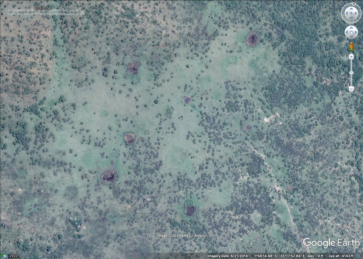
Step 1: Collect satellite imagery

By using publicly available satellite imagery as our input data source, we are able to monitor, detect, and analyze Maasai villages and associated land-based injustice from above. As both historic and current satellite imagery can be collected, we can detect both past and present injustices committed against the Maasai.

The following satellite image sources were used.

  • CNES / Airbus, Maxar Technologies (super high-res.)

  • Sentinel-2, MSI (high-res.)

  • Landsat-98 (medium-res.)

 
Screen Shot 2020-07-17 at 11.40.37 PM.png
skywatch_scale.jpg


skywatch_data_sample.jpg
 

Step 2: Gather training data

In order to autonomously detect Maasai villages, home burnings, and other injustices from above, we used a sophisticated neural network algorithm called Yolo-V3. This particular algorithm has the innate ability to learn what specific objects look like and then accurately detect them at an extremely rapid pace and over large swaths of land. Such a rapid detection system is capable of locating, detecting and reporting land-based data at a rate far beyond human capacity. These kinds of algorithms are called Object Detection Models and are commonly used for real-time tasks such as detecting vehicles for driverless cars or faces for phone cameras.

In order to teach our Object Detection Model to detect villages, we trained it on a custom dataset of 600 satellite images of Maasai villages compiled and augmented within Roboflow, a dataset builder application. Our final training dataset contained images of villages in various states (burned, not burned, etc.) , landscapes (desert, grassland, etc.) and contexts (dense, not dense, etc.), allowing our model to detect villages in varying environments and locate instances of potential injustice.

 
skywatch_dataset.jpg


Screen Shot 2020-07-18 at 12.14.56 AM.png
 

Step 3: Train object detection model

By using FastAi, we trained a Yolo-V3 neural network algorithm to detect Maasai villages and various other aspects such as burn evidence, number of houses, and house materials.

Yolo-V3 was chosen as it can quickly and accurately detect multiple objects in real-time scenarios. As we are scanning vast tracts of land for multiple object types, Yolo-V3 was the ideal algorithm to use.

After training, our model was able to rapidly and accurately locate and detect villages, determine which ones have been burned, provide a house count per village, and detect whether homes were made out of traditional cow dung or metal.

 
Screen Shot 2020-07-18 at 11.07.34 AM.png


Step 4: Evaluate model performance

After training our YoloV3 object detection model, we evaluated its performance by testing it on a series of new images it has never been exposed to before. These images contained unlabelled Maasai villages, burned villages, and corrals for animals set in a variety of landscapes and contexts. As indicated below, our trained model properly identified and label these objects and instances with a high degree of accuracy.

performance 2.jpg


Step 5: Apply model to real world scenarios

After training and testing our YoloV3 object detection model, it was time to apply Maasai Skywatch it to a real-life scenario.

Maasai Skywatch’s first task was to detect and provide burned village data for a disputed Maasai region in Tanzania called the Loliondo region.

in 2014, Tanzanian officials announced plans to illegally sell 1,500 square kilometers of Maasai land to a private luxury hunting and safari company based in the United Arab Emirates. After the deal went through in 2017, over 5,800 Maasai homes were illegally burned or damaged and 20,000 Maasai were forcefully displaced and left homeless.

By feeding historic 2017 satellite imagery of the Loliondo region into our trained Yolo-V3 model, it successfully found and detected both burned and intact Maasai villages at an extremely rapid rate. It also determined the number of homes in each individual village, which if changing over time, may indicate rapid drops in population and potential forced evictions.

 
skywatch_2.jpg
 

Why do we need AI to do this?

Quickly establishing numbers, locations and other details of injustices is imperative to the Maasai as these numbers are often unknown for weeks or months at a time. In the days following the Loliondo evictions, official government reports only indicated that 158 homes were destroyed. Months later and after evidence was manually collected, it was determined that 5,800 had in fact been damaged or burned.

The advantage of AI assistance is its speed and accuracy. While it tooks multiple weeks for NGO’s, word of mouth and manual village visits to determine the extent of damage, a combination of AI and “real time” satellite imagery may help to reduce this time to mere hours or minutes. By providing quick and accurate counts and metrics of land-based injustices with soon after they occur, Maasai Skywatch’s AI technology can one day provide the robust, unbiased, and hard evidence needed to fight many of these social injustices and protect Maasai livelihood and land for many more generations to come.

 
loliondo_issue.jpg


Village detection result sample

 
Screen Shot 2020-07-18 at 12.25.48 AM.png
 
Screen Shot 2020-07-18 at 12.41.13 PM.png
 

Burn detection result sample

Screen Shot 2020-07-18 at 12.26.59 AM.png
 
Screen Shot 2020-05-12 at 11.14.06 AM.png
 

Home count result sample

Screen Shot 2020-07-18 at 12.27.49 AM.png
 
Screen Shot 2020-07-18 at 1.21.36 PM.png


Maasai Community Input

By maintaining frequent back and forth communication with the Maasai diaspora community, the Maasai Skywatch team has been able to appropriately adjust their product to meet the needs, values and requirements of the Maasai themselves. One significant adjustment encouraged by the community includes making the app smartphone accessible. Although some Maasai schools have desktop computers with internet access and large screens, the vast majority of Maasai families do not. Instead, the overwhelming majority of individuals have access to smartphones due to their proliferation across Kenya as the main mode of communication, online personal finance, media consumption, business, and so on. As a result, future development of the app will primarily focus on smartphone friendly compatibility, designs and features.

After their most recent meeting with the diaspora community, one member was confident that the app would be successful among the Maasai community as a whole and could break across political, economic and social barriers.


"the app is symbolic as it is not just about politics. It's about protecting our land, and that is important for all Maasai. I know they will accept that".

- Member of Maasai diaspora community


Similar types of positive confirmation from the Maasai community has encouraged Michael, Luke and Rhys to continue developing their app in order to move it towards full functionality. Though many major components of their app do work, many others are still under development. With the help of the Maasai, they are confident that they can effectively realize their product from conceptual to working product with enough time, effort and support.


Next steps

Though autonomously searching for and detecting Maasai villages and other injustice-based anomalies is possible with our system, doing this in real time and automatically over large swaths of land is still a problem to be solved. By incorporating live-tracking capabilities with software like arcGIS or Google Earth Engine, this future state may soon become a reality. To compliment this aggregated data, additional analytical tools will be necessary to aggregate, breakdown and visualize important metrics related to land-based injustices like village burning counts, changes Maasai village densities, and movement of people over time.

Once the Maasai Skywatch product has been fully developed, it can then potentially be applied to other cultures experiencing similar land related disputes such as the Kachin farmers of Burma who are forcefully being evicted from their land to make room for a Tiger reserve, or the Roma in central Europe who have faced generations of forced evictions and village burnings.


Real time tracking integration using Google Earth Engine

Screen Shot 2020-07-18 at 9.09.39 PM.png
 

Tracking of land-use change overtime

ezgif.com-gif-maker.gif